How to choose the right topographic model for a project: a practical guide

Francisco Piqueras
Choosing the right topographic model is a crucial step in any architecture or engineering project. This article provides a detailed guide to help you select the most appropriate topographic model., ensuring that your project accurately reflects the terrain and relevant topographic features. We will cover everything from assessing specific project needs to practical advice based on professional experience.
1. Introduction to Topographic Models
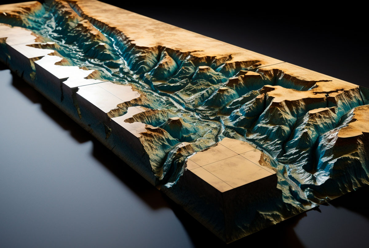
Topographic models are scaled representations of a terrain, crucial for visualizing and planning architectural projects. These models not only represent the topography of the land but also aspects such as contour lines, elevations, and depressions., which makes them indispensable tools in the world of architecture and engineering.
Choosing the right topographic model can make all the difference in the accuracy and success of a project.

2. Key factors in the selection
Selecting the right topographic model requires careful consideration of several key factors:
- Scale of the Model: Scale is crucial in determining the level of detail a topographic model can provide. A larger scale is ideal for projects requiring detailed visualization of specific terrain features, while a smaller scale may be suitable for a project overview.
- Model Materials: Commonly used materials include wood, plastic, and synthetic materials created using 3D printing. Wood offers a classic look and is ideal for durable topographic models, while plastics and synthetic materials allow for greater flexibility and finer details, especially for topographic models with complex contour lines.
- Contour Line AccuracyAccurate contour line representation is crucial for projects involving uneven or steeply sloping terrain. A precise topographic model can help identify potential design and construction challenges.
- Durability and Handling: Consider the model's durability against factors such as light, heat, and physical handling, especially if it will be transported or used frequently for presentations. Additionally, portability is important; the model should be lightweight and portable enough to meet the project's needs.
- Realism and AestheticsFor presentations to clients or stakeholders, the aesthetic appearance of a topographic model can be just as important as its accuracy. A model that combines realism with an attractive presentation can be more effective in communicating the project vision.
By considering these factors, you can choose a topographic model that not only meets the technical requirements of your project, but also facilitates its communication and presentation.
3. Project needs assessment:
Each project has unique requirements, and understanding these is key to selecting the right topographic model. For example, a project involving terrain with significant elevation variations will require a topographic model with detailed contour lines.
In contrast, for projects on relatively flat terrain, a terrain model with less emphasis on contour lines may suffice. Evaluating aspects such as the project scale, the complexity of the terrain, and the purpose of the model (client presentation, design analysis, etc.) will help you make the right decision; below we detail the most significant factors.
- Nature of the Terrain:
- Is the project in an area with significant elevation variations or on relatively flat terrain?
- Are specific terrain features, such as watercourses, rock formations, or vegetation, important?
- Required Details:
- What level of detail is necessary to adequately represent the terrain?
- Are contour lines, elevations, and depressions to be represented with high accuracy?
- Purpose of the Model:
- Will the mockup be used primarily for design analysis, client presentations, or as an educational tool?
- Does the mockup need to be interactive or modifiable for demonstrations or design testing?
- Budget and Available Resources:
- What is the budget allocated for the model?
- Are there time or resource limitations that might influence the choice of material or construction method?
We recommend that, regardless of the model maker you choose, you clarify these points before placing the order. It's important that both parties fully understand the scope and purpose of the model.

4. Comparison of options
When selecting a topographic model, it is essential to know the different types available, each suited to different aspects of an architectural project:
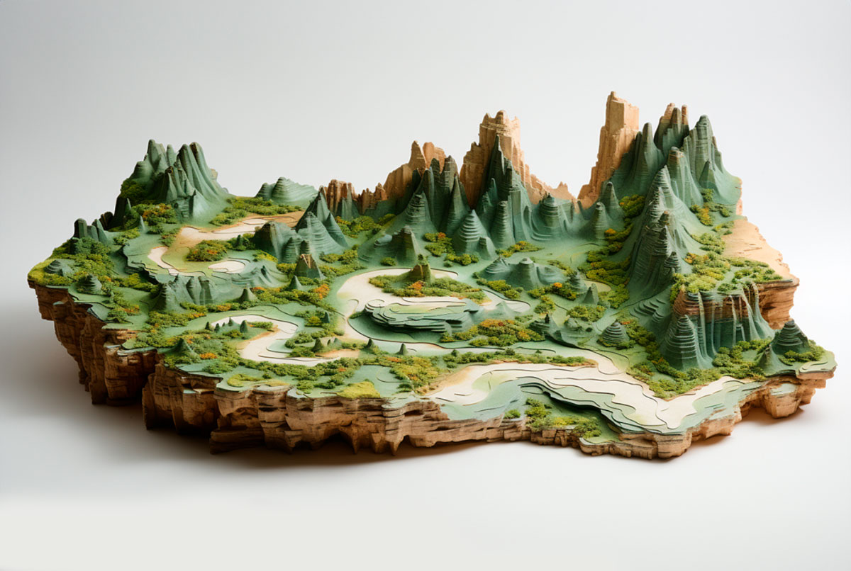
- Traditional Topographic Models: These models are characterized by their construction using materials such as wood or cardboard. They are ideal for representing terrain in a general way, especially useful in projects where elevation variations are not extremely critical. Their focus is more on representing the overall area to scale than on minute details of the terrain.
- 3D Printed Topographic Models: 3D printing technology has revolutionized the creation of topographic models, allowing for unprecedented precision and detail. These models are particularly useful for projects requiring an accurate representation of terrain features, including complex contour lines, subtle variations in elevation, and specific landscape details, although in most cases they are limited to small models no larger than 40 cm on each side.
- Digital Topographic Models: Although not physical, digital topographic models offer a versatile tool for terrain visualization and analysis. Often used in the initial planning stages, these models allow for quick manipulation and adjustments, making them ideal for exploring different scenarios or design changes.
- Hybrid Topographic Models: They combine elements of physical and digital models. For example, a physical base representing the overall terrain with digital overlays showing specific details or potential design modifications. These models are useful for interactive presentations and for facilitating an understanding of how proposed changes would affect the project.
Each type of topographic model has its place in the design and planning process, and the choice will depend on the specific needs of your project, from the conceptualization phase to the final presentation to clients or stakeholders.

Conclusion:
Selecting the right topographic model is a fundamental aspect of the success of any architectural or engineering project. By considering the different types of topographic models and carefully evaluating the specific needs of your project, You can ensure that the terrain representation is as accurate and useful as possible.
If you have any questions about which type of topographic model is best suited for your project, or if you need advice on model selection and design, please don't hesitate to contact us. Our team will be available to help you make the best decision., ensuring that your project is developed with the greatest possible precision and efficiency. Write to us today for a personalized consultation and take the first step towards the successful completion of your project.

Did you like this model?
Want to see other interactive projects?

