How we make a model golf course with real topography

This golf course model was commissioned for Corvera Hills and its new residential golf resort in Murcia, From the outset, it presented a top-level technical challenge: to accurately reproduce the shape and proportions of a complex terrain, where natural areas, landscaped areas and residential architecture coexist. Unlike other more conceptual models, this scale model had to reflect reality as faithfully as possible, which involved careful work reading the terrain, modeling reliefs and adjusting scales.
Each square meter had to have an exact correspondence with its counterpart in the real environment, And that influenced all manufacturing decisions.
A development that combines nature and architecture
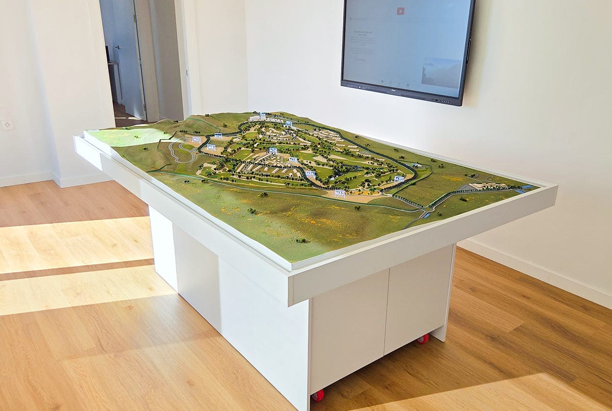
The model represents a development of high landscape value, where the golf course serves as the central axis of the space. The model was built at a 1/1000 scale, a format that allowed for a large area to be covered without sacrificing detail, and which facilitated the inclusion of residential areas, access roads, and surrounding green spaces.
In this context, The relationship between nature and urbanism became the guiding thread of the work., giving rise to a model that not only serves to present the project, but also to understand how the layout of the field and the structure of the built environment interact.
Millimeter precision: a 1/1000 scale model of a golf course
The golf course model built for Clara Ventures was developed at a 1/1000 scale, measuring 213 x 127 cm. This format allowed for a very high level of detail, clearly representing the course layout, landscaped areas, access points, and surrounding buildings. Each element was modeled respecting the original proportions, ensuring an accurate representation of the whole.
The chosen scale allowed for maintaining harmony between the represented surface and visual quality., which facilitated a clear interpretation of the project by the client.
Coherent representation of the area and its surroundings
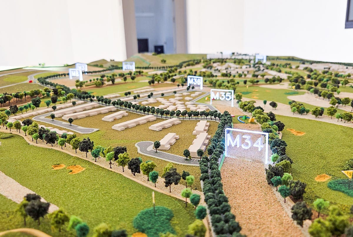
The model includes the golf course and its main buildings, as well as the immediate surroundings, defined by plots, streets, and green areas. Each element of the course—tees, fairways, greens, roughs y bunkers— It was carefully positioned according to the original plan, respecting distances, shapes, and orientation.
The areas outside the playing field were depicted with a more neutral level of detail, using subdued colors and simplified textures. This visual strategy serves to focus attention on the playing area without losing sight of the overall context. The entire set was designed following a criterion of visual hierarchy., with materials and finishes selected to reinforce the balance of the reproduced landscape.
Topographic data as the basis for modeling
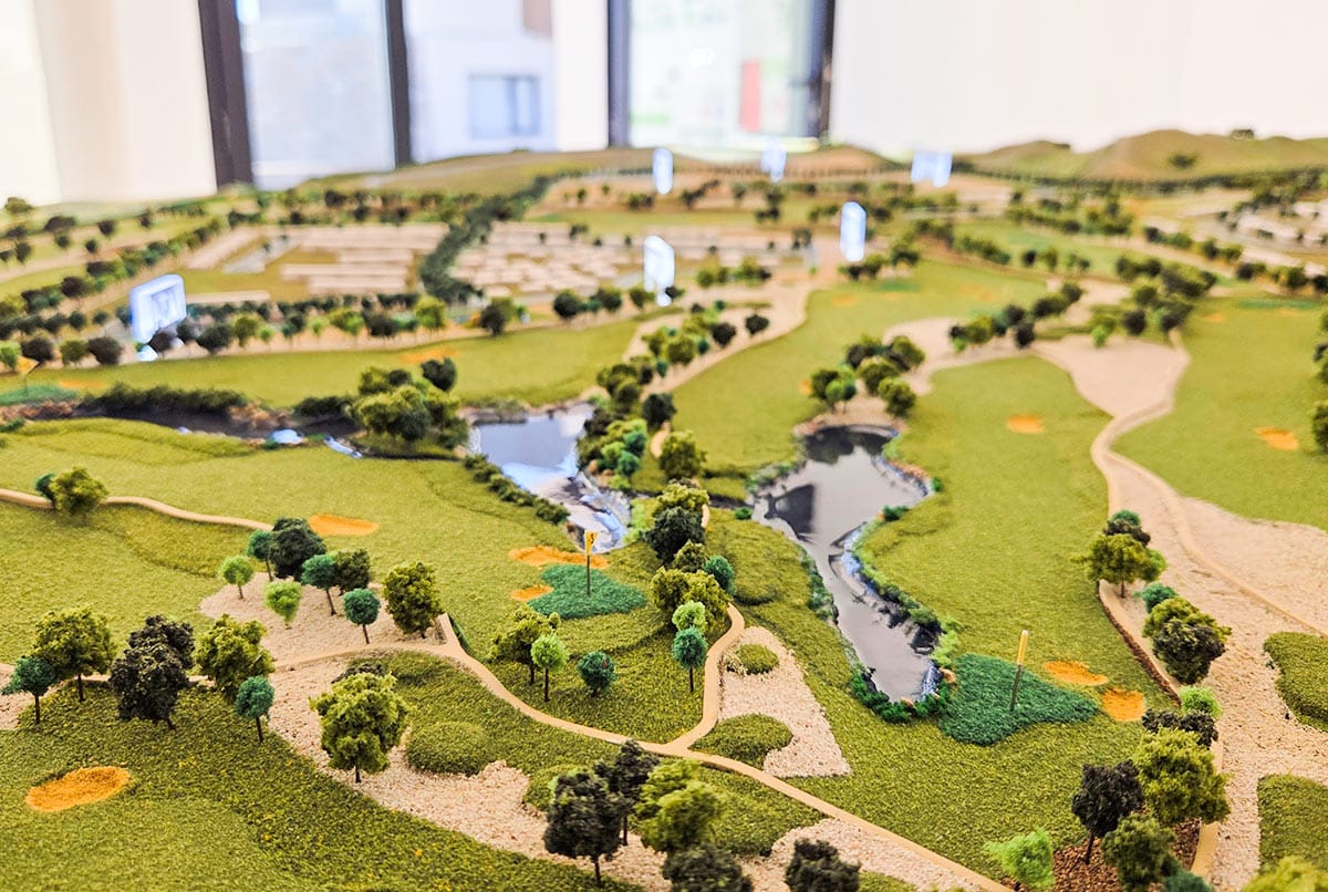
To achieve the desired level of accuracy in this golf course model, The actual topography of the terrain, obtained using LiDAR technology, was used as a reference. The data was captured by a specialized team using drones, generating a detailed three-dimensional scan of the entire area.
Based on that information, We were able to accurately reproduce the unevenness, slopes, and shape of the terrain, respecting the original contour lines of the field. This methodology allowed the geographical reality to be transferred to the physical model with a very high degree of technical accuracy.
Terrain adapted to the format without losing relief
Once processed topographic data, An interpretation and adaptation process was undertaken to integrate the originals into the 1/1000 scale without losing their essence. The terrain was modeled in progressive layers, ensuring that changes in elevation remained smooth and consistent throughout. This decision allowed the character of the landscape to be preserved without creating visual distortions.
Every rise, every depression, and every platform was designed to maintain a clear reading of the relief., respecting the natural identity of the original environment.
Miniature landscape design: details that bring the terrain to life
A fundamental part of the work in this golf course model The goal was to realistically represent the landscaped areas, trees, and natural features of the terrain. High-quality materials such as resins, foams, and printed textures were used to construct paths, lakes, slopes, and green spaces.
Each type of vegetation was selected and strategically placed to reflect its actual location in the original project. The landscape was not only interpreted, but reconstructed in volume, color, and form to faithfully convey its structure..
Manufacturing techniques for a terrain full of nuances
The model incorporates textures created with laser engraving and CNC machining, allowing for the representation of the soil's diversity and subtle changes in relief. Three-dimensional elements were fabricated to simulate shrubs, hedges, and stands of trees., reinforcing the three-dimensional aspect of the whole. The arrangement of these elements does not respond only to visual criteria, but follows the actual references of the project.
Every detail of the terrain was designed to bring realism and coherence to the overall model, without saturating the model or losing the clarity of the design.
Architecture, finishes and visual harmony
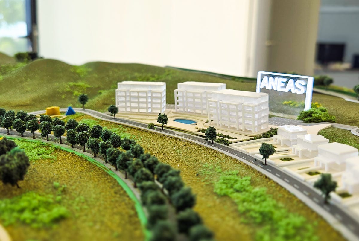
The structures included in this golf course model were developed with a high level of detail, carefully adapted to the scale 1/1000. Synthetic materials such as methacrylate and foamed PVC were used, processed with laser cutting and CNC machining techniques to achieve precise shapes and clean finishes. Interiors were not included, so opaque and translucent surfaces were used to simulate real materials such as glass, concrete, or exposed brick. Each constructed volume was precisely integrated into the terrain, respecting the heights, distances, and proportions of the original project..
Chromatic balance and overall aesthetics
The selection of colors and textures followed a visual logic designed to maintain the coherence of the entire model. Neutral and harmonious tones were used to highlight key elements without creating visual clutter.
The goal was to create a clear, orderly and professional reading of the whole, allowing the viewer to focus on both the countryside and the buildings without distractions.
On this occasion, we would like to thank the Corvera Hills team for the trust they placed in our team for this project. Golf property development in Murcia.

Did you enjoy this article?
Want to see other similar posts?

